
The R/V Thomas G. Thompson left Honolulu on November 5, 2011 heading toward the Western Pacific. This expedition journal was written by cruise participants and uploaded about once per weekday, depending on internet availability.
November 24, 2011: Seeing Below the Surface
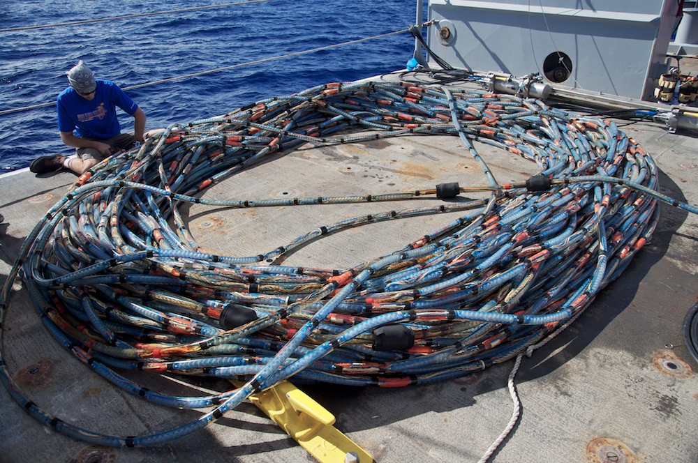
Cable party (Credit: Will Koeppen)
The computer lab, where I spend a sum of eight hours each day is a hub of constant activity. Scientists, crew, and students can be found at the numerous stations scattered around the room, moving from one place to another before running out to work on the stern of the ship. As a watchstander I get a front row seat to all of the excitement happening at the hands of our hard working science and tech teams. I am fortunate enough to be near by the seismic station where I can see a lot of the action taking place. The members of this busy group can be seen moving from the lab to the deck at hurried paces, switching off at the monitoring screens like relay runners. Lucky for me they often need help deploying the seismic gear and always ask for volunteers.
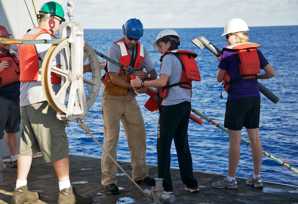
Putting on birds (Credit: Will Koeppen)
I was a bit nervous as I made my way out onto the deck with my life jacket and a hard hat that wasn’t as secured as I had thought. As I was briefed on what I would be doing to help, my hard hat continued to shift as I nodded in understanding, probably making me look like a bobble head on someone’s dashboard. My role in the deployment of the seismic gear was small, but important as I helped Dr. Oakley attach the wooden casing floats, the "birds" that help stabilize the streamer, and the large buoy, also known as “big boy” due to my typos and sloppy handwriting. Deploying all of the seismic gear takes close to an hour and a half, mainly due to the streamer’s long length.
The seismic gear is composed of numerous parts that all work together to bring us coherent data. The first part of the seismic gear to be deployed is a large buoy that helps keep everything afloat. The buoy is attached to a long tube known as the streamer. The streamer is about 870 meters and within its length lies a large collection of wires, network cables, floats and silicone gel, and transmitters. The key components of the streamer are the hydrophones, which are basically underwater microphones. They listen to the sounds around them and send that information back to the lab.
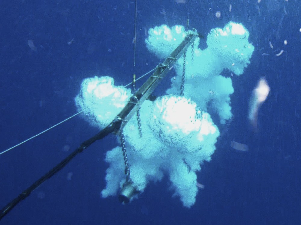
GI gun bubbles (Credit: Captain Patrick Donovan)
You’re probably wondering what in the world they are listening for? We’re in the middle of the Pacific, and there’s not much out here besides water. To answer your question, the hydrophones are listening for the sound of air bubbles that we create using air guns deployed off the back of the ship. The guns send a large pulse of pressurized air into the water, creating a sound wave that travels down to the ocean floor and gets reflected back to the hydrophones. By measuring the time between the guns going off and when their sound returns, we can paint a picture of what the ocean floor looks like. In fact, that sound even travels beneath the seafloor so we can image sediments and oceanic crust. This image of the ocean floor that was recorded through the hydrophones helps a great deal with the other operations occurring on the ship. Specifically, it helps us identify if the old Jurassic section of the crust that we are interested in has been covered by younger volcanic material.
Back at the seismic watchstanding station in the ship, I can watch as the data is plotted on the screen. But while our other instruments give us a picture of just the surface of the bottom of the ocean, the seismic data takes it one step further. Before my eyes, layers begin to appear, and it's up to us to decipher the jumbled history of the ocean floor. ♦