
The R/V Thomas G. Thompson left Honolulu on November 5, 2011 heading toward the Western Pacific. This expedition journal was written by cruise participants and uploaded about once per weekday, depending on internet availability.
November 5–7, 2011: First Steps
For the first few days of the cruise, we will take about ten days to transit to the Western Pacific study area from Honolulu. On the way, we will be testing and calibrating the scientific equipment that we will use to study the Jurassic age seafloor. These tests are important because they help to find problems early on before they hinder the survey.

The USBL pole, just in (Credit: Will Koeppen)
On November 5, we left Honolulu and turned on the CHIRP sonar and multibeam sonar to make sure they worked properly. Both of these instruments will be running almost continuously for the trip, adding to the global database of seafloor data. Off the coast of Oahu, we deployed the TowCam sled (our mid-water magnetometer system) to calibrate it and to get a base line of readings. We also tested the ultra-short baseline (USBL), a system of underwater triangulation using acoustics, to make sure that we will be able to track all of the equipment that will be deployed underwater.
Once the TowCam and USBL tests were complete, we traveled about 27 hours to a pit in the sea floor near 18.4 N, 163.3 W to test the AUV-Sentry. The seafloor in the pit is ~6000 meters below the ocean surface, the same approximate depth as our study area, and it was a good place to test the AUV-Sentry to make sure that the system could withstand the pressure at that depth. This was critical because although the individual parts of the Sentry are rated for the tremendous amount of pressure and have been tested, the system had not been tested as a whole.
We arrived at the pit last night (November 6), and conducted a thorough multibeam scan of the area so we knew what we were getting into. Around 4:30 a.m. this morning (November 7), the AUV-Sentry was deployed and sent to the bottom of the ocean. It stayed down for about 8 hours, reaching a maximum depth of ~5800 meters. Around 1 p.m. today, the AUV-Sentry resurfaced and was brought back on board. Since the Sentry test completed successfully, we deployed the surface towed magnetometer (a.k.a. "maggie") and are now traveling at 12 knots for the next few days towards our survey area. ♦

Sentry team and chief scientists on watch at 1 a.m. as we approach the pit (Credit: Will Koeppen)
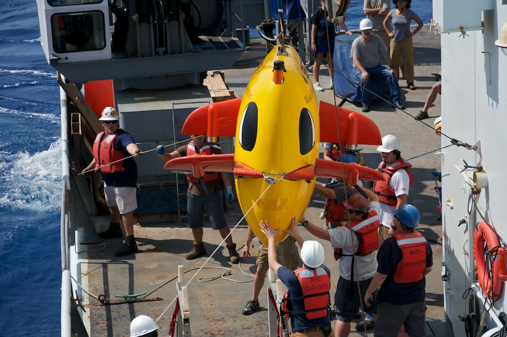
Coming in for landing (Credit: Will Koeppen)