
The R/V Thomas G. Thompson left Honolulu on November 5, 2011 heading toward the Western Pacific. This expedition journal was written by cruise participants and uploaded about once per weekday, depending on internet availability.
November 23, 2011: AUV-Sentry, Part 2
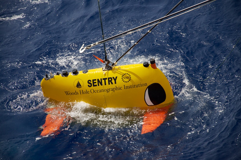
Pretty charismatic (Credit: Will Koeppen)
As the 49 of us aboard the R/V Thomas G. Thompson sail towards the midway point of our expedition, we find ourselves in a position that we (at least those of us with short attention spans) did not expect to be in: still deeply interested and excited about the research and engineering that goes on every day. There is such an abundance of knowledge and excitement behind everything that happens on board. Personally, I believe that the gripping intensity of a AUV-Sentry mission is the pinnacle of this excitement, and I would go as far as saying that many of us have become emotionally attached to this impressive little Chiclet.
Thus far, Sentry’s greatest achievement on this cruise was proving its astounding durability as it dove to much greater depths than ever before. However, this first dive introduced all of the AUV’s adoring fans to a humbling fact about being on the cutting edge of deep sea vehicular technology: with great depth comes great attenuation. For each dive of this cruise, Sentry travels at one knot while taking magnetic data along a section our survey line. I asked Andy Billings how the Sentry team knows where the AUV will surface after running its autonomous near-bottom survey for ~24 hours. His answer was complicated, but in essence it involves using all sorts of wireless signals to track the vehicle at depth and communicate with it once it resurfaces.
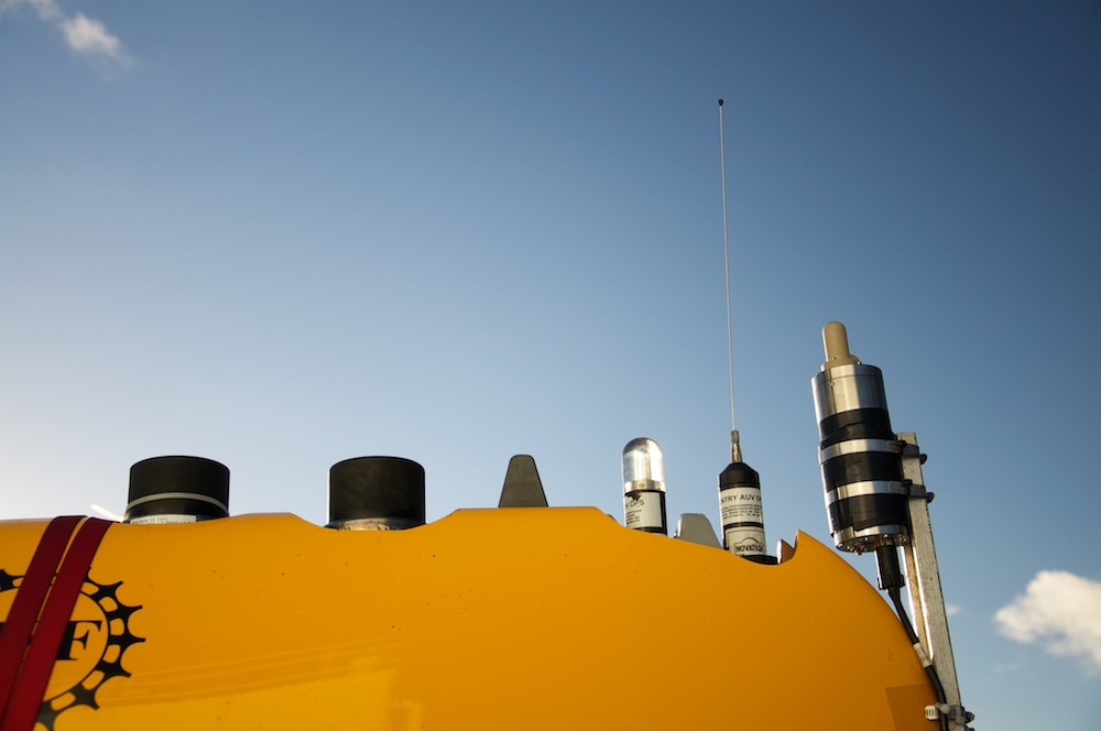
Antennae and beacons (Credit: Will Koeppen)
During the first mission, I remember being very skeptical about the sporadic messages that Sentry was sending back. Throughout the dive, Sentry tries to call home to the ship to tell us how it’s doing and where it is. However, the signals are intermittent because the six kilometers of ocean between Sentry and the ship dampen the signal so much that we must be directly above the vehicle in order to communicate with it. So while Sentry was studying the seafloor, the engineers on board were busy trying to keep a fix on any sort of indication that Sentry was on its predicted course. There was some difficulty in finding the faded long-base-line signal (LBL, commonly referred to as “Sentry’s heartbeat”) that tells us that Sentry is still alive. Ideally, Sentry should also be able to communicate with the ship through the ultra-short base line (USBL) receiver, which informs us about its position, depth, and other diagnostic information, but we weren’t receiving those signals at all. In the end, the Sentry team plotted the AUV’s predicted position based on its programmed speed and heading, and when it came time for recovery we sailed to where we hoped it would be.
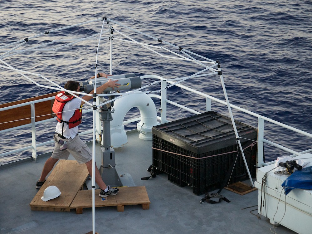
Nick, on watch (Credit: Will Koeppen)
Then, it was time. The time that Sentry was predicted to surface had come and there was no sign of it yet! This was at four in the morning and you could hear a pin drop as every waking eye on the ship was fixed on the dark horizon looking for the strobe light mounted on top of our pride and joy. As we watched and waited, the hour or so that passed felt like an eternity.
All of a sudden, just as you could see the first glimpse of morning twilight, Carl Kaiser, Sentry's team manager, yelled out that he had spotted it in the distance. He saw Sentry through the "big eye" binoculars, which are normally used by our protected species observers to spot sea life. But, surprisingly, the captain had already set course for it somehow. It turns out that Sentry isn’t stuck in the days of SONAR, RADAR and radio communication; for the first time ever, it used its Iridium antennae to send an email with its exact latitude and longitude to James Kinsey, the Sentry team’s expedition leader. This was another new tool for Sentry, and it also calmed many nervous people that were told to scan the visible ocean for this invaluable piece of equipment.
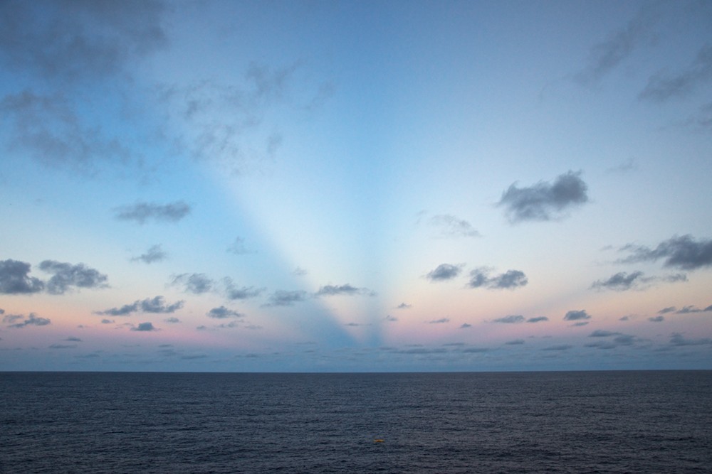
Follow the rays (Credit: Will Koeppen)
After being engaged with the excitement of the challenges faced during the first AUV-Sentry dive, I feverishly anticipated the second one, which was delayed by a storm. This dive was just as nerve-wracking for all of us. Early this morning, we arrived at Sentry's surfacing point awaiting its arrival. This time I found myself perched on top of the bridge, which is the highest part of the ship, in complete darkness. Again, for what felt like an eternity we strained our eyes to see through the clouds of a rainy early morning in the Jurassic Quiet Zone. And quiet it was, there was no sign of Sentry. Finally, three hours later, a few of the very tired bunch of Sentry-spotters, Jen, Masako and myself, spotted Sentry's strobe beacon as it popped up on top of a swell near the horizon.
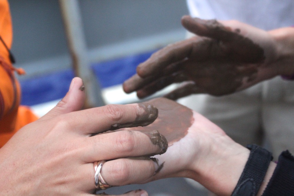
Geologists love abyssal clay (Credit: Nick Mathews)
As we steered the Thompson over to meet Sentry, I found out that we had gone halfway back down Sentry’s projected course to find it. It also turned out that Sentry had brought back a souvenir from the abyssal plain. The geologists on board were excited to collect a sample of red clay from 6000 meters down. However, the mud indicated that Sentry was a bit too close to the seafloor for comfort. With Sentry safely aboard, the team breathed a sigh of relief. But soon they were inspecting the vehicle, looking over the data to understand what had happened, and preparing Sentry for its next dive.
Our experiences with Sentry highlight both the excitement and the risks inherent in using cutting edge technology to do deep sea research. Improving our understanding of the Jurassic ocean crust requires putting this advanced tool in a remote and harsh environment. Twice (so far) on this expedition, Sentry has been to 6000 meters and back. There is only one AUV-Sentry in the world, and at least for the moment we are glad to see it back on board with us. ♦